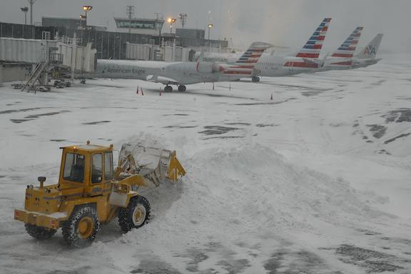
A winter storm sweeping across the eastern U.S. and Canada has grounded more than 1,500 flights, caused traffic woes and promises to leave New York City with a slushy, icy mess throughout Tuesday.

New York may get as much as 4 inches (10 centimeters) of snow before temperatures top 32 degrees Fahrenheit (0 Celsius) later Tuesday, leaving sleet and then rain to end the day, said Dan Petersen, a senior branch forecaster at the U.S. Weather Prediction Center in College Park, Maryland. Boston may get 5 inches of snow.
The storm hasn’t had a major impact on schools , trains and government offices yet, while across the U.S., 1,593 flights were canceled, with New York’s LaGuardia scrapping more than 400 trips as of 6:20 a.m. local time, according to Flight Aware, an airline tracking service in Houston. As the storm blankets parts of Canada, hundreds of flights were grounded in Toronto, Montreal and Ottawa.
Toronto may get about 6 inches of snow and ice, according Environment Canada.
In Chicago, the storm changed to mostly sleet, causing air-travel delays and cancellations.
“It is ending freezing drizzle, which causes delays because the planes have to be de-iced,” Petersen said. “The good news is it will be winding down and ending in the next few hours.”
In Washington, government offices were set to open on time, according to the Office of Personnel Management website, while New York City schools were running according to schedule. The Long Island Rail Road, Metro-North Railroad, New York buses and subways reported good service, according to the Metropolitan Transportation Authority website.
Northern Wisconsin, parts of Michigan, upstate New York and northern New England probably will get the heaviest snow with as much as 12 inches, Petersen said. The system will exit the region by Wednesday. Winter storm and weather advisories stretch from Iowa to Maine.


